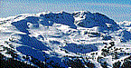

Ski Weather Report for Western Mogollon Rim, Flagstaff, 02/23/2019 6am
| Day | Grade | Temps | Weather | Forecast |
|---|
Check Out the Snow Pack and Temps from the Weather Stations
Source Forecast Courtesy of NOAA
Home SkiReport SnowCAMs WeatherPics WeatherForecast WeatherStations ContactUs


Copyright © 2000-2018 by skiTiger.com Disclaimer
