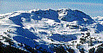

It's Monday November 26. Good morning, this is skiTiger.com with the Northwest snow report.
Looking around the Northwest the last three days.
Oregon had no new snow.
Washington had no new snow.
In Idaho, Lookout Mountain reported 12 inches of new snow today, and Pomerelle Mt. reported 8 inches of new snow today.
The following resorts have the top snow depths in the region.
In Oregon, Mt. Hood Meadows has a 18 inch base, and Mt. Hood Skibowl has a 9 inch base.
In Washington, Mission Ridge has a 23 inch base, and 49 Degrees North has a 10 inch base.
In Idaho, Pebble Creek has a 22 inch base, Pomerelle Mt. has a 13 inch base, Bald Mountain has a 12 inch base, and Lookout Mountain has a 10 inch base.
The ski forecast for the next few days looks like this.
In Oregon,
Mon., Partly cloudy. A 20 percent chance of showers and thunderstorms late in the afternoon. Snow level above 8000 feet. Northwest wind 5 to 10 mph.
Mon. PM, Mostly cloudy. A chance of showers and a slight chance of thunderstorms in the evening, then a chance of showers and areas of drizzle after midnight. Snow level above 8000 feet. West wind 5 to 10 mph. Chance of precipitation 50 percent. Rainfall amounts
Wed., Mostly cloudy. A chance of showers and areas of morning drizzle, then a chance of showers in the afternoon. Snow level above 8000 feet. West wind 5 to 10 mph. Gusts to 20 mph in the afternoon. Chance of precipitation 50 percent. Rainfall amounts less tha
Wed. PM, Mostly cloudy. A chance of showers in the evening, then areas of drizzle and a slight chance of showers after midnight. Snow level above 8000 feet. West wind 5 to 15 mph. Chance of precipitation 40 percent.
Thur., Mostly cloudy. Areas of drizzle and a slight chance of showers in the morning, then a slight chance of showers in the afternoon. Snow level 7500 feet. West wind 5 to 10 mph. Chance of precipitation 20 percent.
Thur. PM, Partly cloudy with a 20 percent chance of showers. Snow level 7500 feet.
Fri., Partly sunny with a 20 percent chance of showers. Snow level 7000 feet, increasing to above 8000 feet in the afternoon.
In Washington,
Mon., Sunny. Freezing level near 11500 feet.
Mon. PM, Mostly clear. Freezing level near 11500 feet.
Wed., Mostly sunny. A slight chance of thunderstorms in the afternoon. Snow level near 10000 feet.
Wed. PM, Partly cloudy. A slight chance of thunderstorms in the evening, then a slight chance of showers after midnight. Snow level near 10500 feet.
Thur., Partly sunny. A chance of showers and a slight chance of thunderstorms in the afternoon. Snow level near 10000 feet.
Thur. PM, Mostly cloudy. A chance of showers, snow showers and a slight chance of thunderstorms in the evening, then a chance of showers after midnight. Snow level near 10000 feet.
Fri., Partly sunny with a chance of showers. Snow level near 9000 feet.
In Idaho,
Mon., Sunny. Highs in the mid to upper 80s.
Mon. PM, Mostly clear. Lows in the lower to mid 50s.
Wed., Partly cloudy in the morning, then mostly cloudy with a chance of showers and thunderstorms in the afternoon. Highs in the upper 70s to lower 80s. Chance of precipitation 50 percent. Rainfall amounts less than a tenth of an inch, except higher amounts po
Wed. PM, Rain showers likely and a chance of thunderstorms. Lows in the lower to mid 50s. Chance of precipitation 70 percent.
Thur., Rain showers likely and a chance of thunderstorms. Cooler. Highs in the mid 60s to lower 70s. Chance of precipitation 70 percent.
Thur. PM - Fri., Mostly cloudy with a 50 percent chance of rain showers. Lows in the upper 40s to lower 50s. Highs in the mid 60s to lower 70s.
Fri. PM - Mon., Partly cloudy. Lows in the lower 40s to lower 50s. Highs in the mid 60s to mid 70s.
Thanks for checking with skiTiger.com, for the most update info on your favorite resorts, check out www.skitiger.com for all your ski/ride reports

www.SkiTiger.com Snow Report Snow Cams
Home SkiReport SnowCAMs WeatherPics WeatherForecast WeatherStations ContactUs


Copyright © 2000-2018 by skiTiger.com Disclaimer
