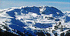

It's Tuesday August 31. Good morning, this is skiTiger.com with the Northwest snow report.
Looking around the Northwest the last three days.
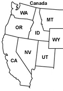
In Idaho,
Tue., Increasing clouds. Light rain likely in the afternoon. Highs in the mid to upper 60s. South wind 5 to 15 mph in the afternoon. Chance of precipitation 60 percent. Rainfall amounts less than a tenth of an inch.
Tue. PM, Light rain. Lows in the lower 40s to lower 50s. Chance of precipitation 90 percent. Rainfall amounts between a tenth and a quarter of an inch possible.
Wed., Mostly cloudy. Rain showers likely in the morning... Then a chance of rain showers in the afternoon. Highs in the mid 60s to lower 70s. Chance of precipitation 60 percent. Rainfall amounts less than a tenth of an inch.
Wed. PM, Partly cloudy. Lows in the upper 30s to lower 40s.
Thur., Sunny...Warmer. Highs in the mid to upper 70s.
Thur. PM - Fri., Mostly clear. Lows in the upper 30s to upper 40s. Highs in the lower to mid 80s.
Fri. PM - Sat., Partly cloudy. Lows in the mid 40s to lower 50s. Highs in the upper 70s to lower 80s.
In Oregon,
Tue., Becoming cloudy. Rain likely North by afternoon with a chance South. Snow level above 8000 feet. Pass winds West 5 to 15 mph.
Tue. PM, Rain at times North and a chance South. Snow level above 8000 feet. Pass winds West 10 to 15 mph.
Wed., Rain at times North in the morning then a chance of showers. A chance of rain South in the morning then a chance of showers. Snow level above 8000 feet. Pass winds Southwest 5 to 10 mph shifting to the West 5 to 15 mph in the afternoon.
Wed. PM, Mostly cloudy in the evening...Then partly cloudy. Free air freezing level 15000 feet. Pass winds North 5 to 10 mph.
Thur., Partly sunny in the morning...Then sunny. Warmer. Free air freezing level 16000 feet. Pass winds East 5 to 10 mph.
Thur. PM, Clear. Free air freezing level 16000 feet.
Fri., Sunny in the morning...Then partly sunny. Free air freezing level 15000 feet.
In Washington,
Tue., Rain. Snow level 7000 feet. Afternoon Pass temperatures near 50. West wind in the Passes near 10 mph this morning becoming light.
Tue. PM, Rain in the evening...Decreasing after midnight. Snow level 8000 feet. West wind in the Passes 10 to 15 mph.
Wed., Showers likely in the morning...Then mostly cloudy with a chance of showers in the afternoon. Snow level 7500 feet. Afternoon Pass temperatures in the mid 50s. West wind in the Passes near 10 mph in the morning becoming light.
Wed. PM, Mostly cloudy with a chance of showers in the evening...Then partly cloudy after midnight. Snow level 10000 feet. West wind in the Passes near 10 mph in the evening becoming light.
Thur., Mostly sunny. Freezing level 12500 feet. Afternoon Pass temperatures in the upper 60s. Light wind in the Passes becoming Southeast near 10 mph in the afternoon.
Thur. PM, Mostly clear. Freezing level 13500 feet.
Fri., Mostly sunny. Freezing level 13500 feet.
Thanks for checking with skiTiger.com, for the most update info on your favorite resorts, check out www.skitiger.com for all your ski/ride reports

www.SkiTiger.com Snow Report Snow Cams
Home SkiReport SnowCAMs WeatherPics WeatherForecast WeatherStations ContactUs
Copyright © 2001-2010 by skiTiger.com Disclaimer
