
It's Friday November 6. Good afternoon, this is skiTiger.com with the Northwest snow report.
Looking around the Northwest the last three days.
Washington had no new snow.
Idaho had no new snow.
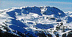
In Oregon, Mt. Bachelor reported 9 inches of new snow today, and Mt. Hood Meadows reported 9 inches of new snow today.
The following resorts have the top snow depths in the region.
Washington had no reported snow depths.
Idaho had no reported snow depths.
In Oregon, Mt. Hood Meadows has a 9 inch base, and Mt. Bachelor has a 7 inch base.
The ski forecast for the next few days looks like this.
In Washington,
Fri. !, Winter storm warning in effect until 4 am pst Sun....
Fri. PM, Breezy...Showers and scattered thunderstorms. Snow level 3500 feet. Snow accumulation 4 to 10 inches. Southwest wind in the Passes 15 to 25 mph.
Sat., Breezy...Showers and scattered thunderstorms. Snow level 3500 feet. Snow accumulation 4 to 12 inches. Afternoon Pass temperatures in the mid 30s. Southwest wind in the Passes 15 to 25 mph.
Sat. PM, A chance of thunderstorms in the evening. Showers. Snow level 3000 feet. Snow accumulation 3 to 10 inches. Total snow accumulation 10 to 26 inches. Southwest wind in the Passes 15 to 20 mph.
Sun., Cloudy with a chance of showers. Snow level 3500 feet. Afternoon Pass temperatures in the mid 30s. West wind in the Passes near 15 mph becoming Southeast in the afternoon.
Sun. PM, Breezy. Mostly cloudy with a chance of rain and snow. Snow level 4500 feet. Southeast wind in the Passes 15 to 25 mph.
Mon., Rain and snow likely. Snow level 4500 feet. Afternoon Pass temperatures in the mid 30s.
In Idaho,
Fri. !, Winter storm watch in effect from Sat. morning through late Sat. night above 3500 feet...
Fri. PM, Cloudy. Scattered rain and mountain snow showers in the evening...Then numerous rain and mountain snow showers overnight. Mountain snow accumulation of 1 to 3 inches. Snow level 4000 feet in the evening...Lowering to 3000 feet overnight. Lows in the lowe
Sat., Rain or snow showers. Snow accumulation of 1 to 3 inches above 3500 feet. Highs in the lower to mid 40s. Southwest wind 5 to 15 mph with gusts to around 30 mph. Chance of precipitation near 100 percent.
Sat. PM, Rain or snow showers. Snow accumulation of 1 to 3 inches. Total snow accumulation up to 10 inches above 3500 feet. Lows in the lower to mid 30s. South wind 5 to 15 mph with gusts to around 25 mph. Chance of precipitation 80 percent.
Sun., Cloudy with a 40 percent chance of rain or snow showers. Snow level 3000 feet. Highs in the lower to mid 40s. Southwest wind 5 to 15 mph in the morning...Becoming light in the afternoon.
Sun. PM, Mostly cloudy. A slight chance of rain or snow showers in the evening...Then a slight chance of snow showers overnight. Snow level 3000 feet. Lows in the upper 20s to lower 30s. Chance of precipitation 20 percent.
Mon., Partly sunny with a 20 percent chance of rain or snow. Highs in the lower to mid 40s.
In Oregon,
Fri. !, Winter weather advisory in effect until 4 am pst Sun....
Fri. PM, Rain and snow showers. Snow level 3500 feet. Snow accumulation of 5 to 10 inches. Pass winds Southwest 10 to 20 mph.
Sat., Rain and snow showers in the morning...Then rain and snow showers likely in the afternoon. Breezy. Snow level 4000 feet. Snow accumulation of 5 to 10 inches. Pass winds Southwest 15 to 25 mph.
Sat. PM, Rain and snow showers. Snow level 3500 feet. Snow accumulation of 4 to 7 inches. Pass winds Southwest 10 to 20 mph. Gusts to 35 mph in the evening.
Sun., Mostly cloudy. A chance of rain and snow showers in the morning...Then a slight chance of rain and snow showers in the afternoon. Snow level 4000 feet rising to 4500 feet in the afternoon. Pass winds South 5 to 15 mph.
Sun. PM, Mostly cloudy. Free air freezing level 5500 feet rising to 6000 feet after midnight. Pass winds Southwest 5 to 15 mph.
Mon., A chance of rain in the morning...Then rain in the afternoon. Snow level 6500 feet.
Thanks for checking with skiTiger.com, for the most update info on your favorite resorts, check out www.skitiger.com for all your ski/ride reports
www.skiTiger.comSnow ReportNW Snow CamsHome SkiReport SnowCAMs WeatherPics WeatherForecast WeatherStations ContactUs
Copyright © 2001-2008 by skiTiger.com Disclaimer
